Navigators for Android. Yandex Navigator: navigator with voice control
Read also
GPS navigation is one of the most popular features on a smartphone. When exploring a city by car or bicycle, it is essential to follow the best route. Navigators will help you optimize auto and pedestrian routes and get to the desired coordinates faster.
We compared popular, top mobile navigators. Main criteria: ease of use, functionality and price (free) of the navigator. At the end of the review, we will summarize: which navigator is the best.
Participants:
Over time, the review will be updated with new GPS programs. If, in your opinion, there are more interesting navigators for Android, leave your comments at the end of the article, via contact form. Thank you!
Google Maps for Android - standard Android navigator
Reviewing Google Maps a year ago, we noted that some functions of the navigator were not finalized or optimized. By 2019, the situation had improved markedly – especially in terms of user experience. However, we note some of the rough edges of Google Maps.
The function of downloading offline maps appeared relatively recently. It allows you to plot routes and navigate on the map without an Internet connection. Due to the fact that offline maps are not yet a fully tested function, not everything is so smooth with it. However, like other Android navigators.
The inconvenience is that you cannot download maps for large regions of Ukraine, Russia, Belarus and other CIS countries. Only selected offline maps of large cities or regions are available. When driving outside the city limits, it is difficult for a motorist to do without online synchronization.
Disadvantages of Google Maps
1) The choice of locations and attractions in Google Maps is quite poor: to get full information about hotels, restaurants, shops, schools, etc. available nearby - you have to use third-party applets (Foursquare, TripAdvisor, Yandex.City).
2) No data on road accidents; You cannot add points with car accidents yourself, which would be quite useful for notifying other drivers.
3) In comparison with Yandex Navigator, there is no warning about speed control, there are no alternative voice assistants.
Advantages of Google Maps
However, Google Maps also has many positive aspects.
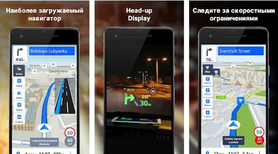
Yandex Navigator: navigator with voice control
Interface mobile version Yandex Navigator is well structured and clear. When driving a car along a route, it displays information about the approximate time remaining to the destination and the distance to the final point. If you need to stop at a service station, gas station or car wash along the way, you can specify an additional point on the Yandex Navigator map - and the route will be optimally recalculated taking into account the intermediate point. You can turn the traffic and directions layer on and off by pressing a single button with a yellow traffic light.
The exclusive features of the navigator include the night GPS mode for Android, where the map is displayed in dark colors, without distracting the driver’s attention when driving late and prevents the eyes from getting too tired when looking at objects. By the way, the range of searchable POI objects is really impressive. Along with the already familiar restaurants, ATMs and cinemas, you can use layers to display nearby communication points, post offices, salons and many other interesting places.
Another nice feature is voice control from your phone. Similar to Google Maps, you can search for the necessary objects on the map, request addresses on the map.
As for the program's offline operation, you can download GPS maps for Android for major settlements in Ukraine, Russia and Belarus. By turning on Yandex Navigator offline, you can view them, but plotting routes and searching for local attractions on the map is only possible if you have a network connection.
Thus, Yandex Navigator for Android leaves the most pleasant impression. The product claims to be the best free gps navigator for Android in 2019.
Navitel: a well-designed GPS navigator for Android
Navitel Navigator is a GPS program from a leading developer in the field of navigation and creation digital cards. To purchase the cards themselves, you will have to fork out a small amount, but if you wish, you can download them for free on torrents or file hosting sites (for example, on the pda forum).
Strengths of Navitel Navigator
1) Map display options: switch between 2D and 3D modes, which will be especially useful in some situations.
2) User-friendly interface. The lion's share of branded chips is available in top line For quick access. Choosing between night and day skins
4) Switching between satellites: under any weather conditions, the map with POI is always available.
Note. Not long ago we did something for Android, where we listed in detail all the advantages and individual “features”.
Navitel Navigator: GPS routes on the screen
5) Convenient controls. When navigating along a route, managing the map is quite intuitive and simple: there is a zoom function, rotation of the map according to movement, and the ability to switch between preset profiles for any type of transport.
6) Information content. The movement is visually accompanied by information about the speed of the object, the remaining time to reach the destination, the distance of the nearest turn and audio support. In general, the navigation is well thought out and intuitive.
Well-thought-out functional parts and high-quality design make mobile app Navitel is the main candidate in the “Best” nomination gps navigator for Android."
Waze - an informative GPS navigator for Android
Waze (Free) is a free navigator for Android with opensource code.
Benefits of Waze
1) The social features integrated into Waze greatly improve your driving experience. Waze users report problems on the road - be it repairs, accidents, traffic jams, traffic police posts, cameras and other “troubles”. Accordingly, other drivers are already aware of the changes. In addition to reviews, the application collects information from its own database on the server.
2) The map with routes is informative. Waze uses proven OSM maps. They are highly detailed and accurate.
3) Waze automatically reroutes if your phone crashes, the app crashes, or anything else that might interrupt your navigation. Standard Google Maps doesn't do this. Likewise, Waze makes it easy to view your route or map when needed and always returns to Automotive mode.
OsmAnd: navigation for Android in offline mode
Let's list the strengths of the OsmAnd navigator.
Pros of OsmAnd
1) Autonomy. OsmAnd is, first of all, a good offline navigator. Suitable for those who prefer to download maps to their gadget once and no longer connect to the Internet while in offline mode.
2) Cards. For navigation in OsmAnd, raster and vector maps of Open Street Maps are used, compiled by users of the service. They allow you to filter POI objects (attractions, museums, theaters, pharmacies, etc.) and select a profile for the corresponding vehicle. The travel route can be optimized taking into account the shortest distance, avoiding toll roads, dirt roads, ferries, and highways.
OsmAnd is one of the best navigators for Android
3) Customizable maps. You can add objects yourself, create or edit maps. Thanks to the support of plugins, the functionality of OsmAnd is significantly expanded: for example, you can activate the OsMo live monitoring system with tracking of other gadgets using the service; add to groups; download sea and ski maps; calculate optimal distances between specified points using GPX; impose contour lines and layers of relief, which will certainly be appreciated by tourists and athletes).
4) Additional functions. All standard features for GPS navigators are also present: voice control, assistant, screen reorientation, profile switching.
Maps.me
Maps.me is a GPS navigator, popular in Russia, the USA and Germany. Characterized by high accuracy and autonomy of cards.
Strengths of Maps.me
1) The accuracy and detail of maps is perhaps the most important thing, regardless of the type of transport. This navigator will be of interest to travelers and pedestrians, since the map displays the smallest details - trails, benches, names of objects.
2) Additional layers. Maps.me displays vector maps, through layers you can also display traffic jams and .
3) Lots of settings. In the maps.me settings you can change units of measurement, scaling, view your movement history, etc. There are navigation settings, in particular, you can configure auto zoom, voice instructions, and enable the display of speed cameras.
4) Switching navigation modes. The choice is car, pedestrian, public transport, taxi and bicycle.
5) Autonomy. Offline maps downloaded to a mobile device take up little space, but work fully, as if the Internet were present. It is clear that realtime functions will not be available, but information about traffic jams is not as important for a pedestrian or cyclist as it is for motorists.
Disadvantages of Maps.me
1) Limited navigation for motorists. It’s difficult to call Maps.me a perfect car navigator. At a minimum, travel routes are not always lined up correctly, not to mention the fact that the navigator does not offer alternative options.
2) There are errors. Since the maps are developed by the community, the data is not always up to date, especially for remote places and villages.
3) Quite inconvenient map display mode. Maps look very dry, scaling may not work.
Which navigator is the best as of 2019?
Each of the Android navigators, in some aspects (functions, maps) is better than its competitors and is good in its own way. Which navigator is right for you depends on your preferences and beliefs. We hope that we helped you choose the right application and it will remain on your phone.
| Navigator application | Developer | Price | Offline map support | Traffic jams | Voice acting | Russian language |
| Google Maps | Google Inc. | for free | + | + | + | + |
| Yandex Navigator | Yandex | for free | + | + | + | + |
| Navitel Navigator | Navitel | from 1000 rub. | + | + | + | + |
| Waze | Waze navigation | for free | + | + | + | + |
| OsmAnd for Android | OsmAnd | from 6.75 $ | + | + | + | + |
Yandex Navigator It is absolutely free and has excellent functionality. It wins the category "Best navigator for Android with support for Yandex Maps."
Navitel Navigator created and supported by the most famous company, so the quality of products and technical support are at their best - both for Android OS and others mobile devices.
Navigation app Waze- certainly attracts with its openness and free cards. However, like any developing product, this navigator is not perfect. We hope the growing community will have a positive impact on the quality of the application. As of 2019, alas, Waze maps are inferior in information content to the same Navitel or Google Maps.
Concerning OsmAnd, then this offline navigator for Android will serve perfectly in conditions where it is impossible to connect a mobile device to the network and works using open technologies.
Google Maps- navigator with voice control function. The good thing is that it is available out of the box (that is, it is initially included in Android). Google Maps is suitable for inexperienced travelers and drivers; it can be called one of the best offline navigators.
Maps.me will appeal to avid travelers and walkers. The navigator will delight you with detailed maps adapted for walking. We would recommend alternatives to motorists - Google Maps or Yandex Navigator.
Good afternoon friends. Today we will talk about navigators installed on Android and working without the Internet. Is it worth mentioning that navigators have made life much easier for drivers in different countries. Many people simply stopped taking various atlases and road maps with them different parts Earth.
But you don’t always have navigators at your fingertips, which can’t be said about your mobile phone. Also, on the road, the Internet often disappears. Therefore, a decent number of navigator applications for Android have been developed that function without the Internet. By installing this software on your phone, you can choose a shorter and safer route to the desired location, including in an unfamiliar city or country. I suggest you consider 10 such navigators of 2019 on Android and choose the one you like best.
Sygic

This offer is very popular in many countries. But many drivers have found that if the program is used for a long time, the information provided is not entirely reliable. Most likely, some places on Earth simply stopped supporting this software.
But despite this, Sygic is still one of the main leaders among offline navigator programs for smartphones. This application has a good design that is easy on the eyes and fingers. In addition, the program can function using only GPS, which makes it possible to work efficiently without a constant connection to the Internet. The software updates its topographic databases for free in most regions of the Earth.
Overall, this app is one of the best choices for people who spend a decent amount of time on the road. Even if for a number of reasons GPS and the Internet stop working, thanks to the downloaded maps, people will be able to navigate the area. To obtain additional features, like voice accompaniment and detailed instructions, you need to install the PRO version.
Download Sygic.

Until recently, this navigation program did not shine among a number of navigator programs. But, MapFactor developers began to carry out endless updates and improvements to the application. As a result, this software took the top three among similar applications of the Android system.
Its main advantage is that once you install the program on your gadget, you no longer need the Internet for excellent navigation on the ground. It is only necessary to update the application every month to update information about changes in cartography.
MapFactor provides navigation routing in many languages and allows you to plan your route ahead of time. The program makes it possible to see the required route in both 2D and 3D formats. That is, both a map with all the details, and in a simplified form.
For example, when traveling on highways between cities, it is preferable to use simple cards, due to the fact that you only need to carefully observe the movement. If you are in a populated area, it is better to use maps with all the nuances, such as gas stations, food outlets, recreation and other landmarks.
Download the navigator without the Internet for Android MapFactor.

If you have a smartphone or tablet with GPS and GLONASS support, it would be strange not to use it for navigation. And for the device to learn how to lay out routes for you, it is enough to equip it with a navigator application with maps of the area. There are quite a lot of applications of this kind, but not all of them are equally useful. We hope this article will help you choose a navigator for Android that will satisfy your needs in the most worthy way. The rating is based on the opinions of experienced drivers and travelers.
Waze
The developer positions Waze as a navigator that the Russian driving community helps develop. And, I must say, such collective support is beneficial for the application: many drivers switch to Waze from other navigators that they had previously used for years.
The program allows each traffic participant to add information to it themselves: report accidents, traffic jams, road works, traffic police ambushes, prices at gas stations and other things that may be useful to other users.

Waze features and functionality
Drivers value Waze for its up-to-date information, laconic interface, stable operation and, of course, free use. A big plus is that the program does not lose routes when Internet access is lost and automatically stops accessing GPS if not used during stops. This reduces the rate at which the battery drains.
Among the shortcomings of Waze, some users included the lack of a 3D mode and not always working correctly voice search.
Yandex.Navigator

Another free application that travelers have ranked among the top navigators for mobile devices. Contains very detailed and detailed information useful for both drivers and pedestrians who are in unfamiliar areas in Russia, Ukraine, Azerbaijan, Georgia, Belarus, Armenia, Kazakhstan, Tajikistan, Moldova and even Turkey (note to tourists).

Features of Yandex.Navigator
- Construction of up to three route options to a given object, taking into account traffic jams and other road events.
- Warning about toll roads and ferry crossings.
- Displays the number of kilometers left to travel to the final destination, as well as the remaining time until arrival.
- Voice accompaniment trips with notifications about maneuvers, speed limits, road events, radars and traffic police crews, etc. Displaying them as symbols on the map.
- Driver warning about speeding.
- Voice control. The option is designed much better than in Waze. By activating control of the “Listen, Yandex” command, you can request a route to a desired point or search for an object on the map.
- Reporting information about traffic events to the program, including by voice.
- Storing the history of trips and routes.
- Search for parking lots (all - only in Moscow within the Third Ring Road; in other places of the capital and some large cities - St. Petersburg, Kazan, Kyiv, Minsk, Nizhny Novgorod, etc., separate large parking lots are displayed).
The best thing that, according to users, Yandex.Navigator has is the coverage of a large territory (especially convenient for those who travel a lot in Russia and neighboring countries) and the ability to control without hands. Disadvantages: maps are not always up-to-date, especially in regions remote from the center and small towns. And also that the program takes up too much space in the device’s memory due to the inability to move cards to removable media.

Although - paid application(the cost of content starts from 560 rubles), it was preferred by more than 20 million users around the world. After all, this is, in fact, the standard by which developers of other navigation programs are compared. Among its analogues, it has perhaps the largest range of functions, and there is no driver who would say that Navitel’s capabilities are not enough for him.

A short list of functions and features of Navitel
If you install Navitel from the store Google Play, he will be tied to yours account Google, not to the device. Thanks to this, you can use the program on different gadgets.
Navitel's greatest strengths, according to drivers, are rich functionality, always up-to-date information, big choice cards and technical support. The reasons for negative reviews are, as a rule, limitations of the 7-day trial version, local glitches, minor inaccuracies on the maps - the same as everyone else similar programs.
Maps.me

Maps.me is a free Android navigator with open source code from Mail.Ru Group. It also works without Internet access if you download the necessary maps in advance. Designed not only for drivers: in addition to roads, Maps.me maps contain walking and cycling tourist routes in many countries around the world.

Key features of Maps.me
- Saving mobile internet traffic and battery charge. Important for those traveling by bicycle and on foot, especially where there is no cellular coverage (for example, in the forest).
- The routes are always up to date and very detailed. Maps include features that other apps don't have, as the latter are more geared toward the needs of motorists rather than pedestrians.
- On walking and cycling routes, the degrees of slope of the area are indicated - downhill or uphill.
- Users of the program, of whom there are more than 65 million worldwide, participate in the compilation of maps. And you can join their community too.
- In addition to creating routes, Maps.me helps you search for various objects on the ground. Search categories: catering outlets, hotels and hostels, ATMs, bus stops public transport, attractions. The search function is available both online and offline (offline).
- You can book a hotel room directly from the app (only available online through the Booking.com website).
- The program allows you to send messages to your loved ones indicating your current location. For this purpose they can be used cellular(SMS), social media and web messengers.
The main advantages of Maps.me, according to experienced travelers, are: free access to all functions, a large selection of maps (the latter, by the way, are well optimized for mobile devices: with the same amount of content as in other programs, they take up much less space in the gadget’s memory), as well as taking into account the needs of pedestrians and cyclists.
The application has, perhaps, only one significant drawback. Because maps are created by users, the data often contains errors. In addition, some maps are better designed than others. This again comes down to user engagement: where people are more active, maps are more detailed and accurate. And vice versa.
Google maps, transport and navigation

is another free and widely available Android navigation app. Used and supported by perhaps the world's most impressive user community. Helps you navigate unfamiliar terrain and plan a route for travel in almost any locality on the globe.

Features of Google.Maps
- Quickly build routes taking into account the situation on the road. If obstacles appear - traffic jams, accidents, etc., the route is automatically rebuilt. Automatic selection of the least congested lane.
- Dynamic POI.
- The ability to quickly obtain information about objects of interest in the area, for example, catering outlets. Information about the latter may include user ratings, interior photos, reviews, opening hours, prices, menus, etc.
- Possibility to leave reviews about the places visited.
- Always up-to-date information on public transport routes.
- Unique feature: displaying the interior layouts of large public buildings: shopping centers, train stations, airports and stadiums, which helps visitors not to get lost in them.
- Description of more than 100 million objects around the world, as well as more than 220 regions and countries.
Travelers appreciate Google maps primarily for simplicity, accessibility and convenience. And many people called the strange experiments of the developers, such as the integration of the Pac-Man game into the program, as shortcomings, or rather, excesses, which only distracts the driver while driving and does not carry anything useful.
We reviewed the best navigators for Android smartphones and tablets. Choose the best option that suits all your needs.
Yandex Navigator - great program for both motorists and pedestrians. Like Yandex Maps, stands out from its competitors with its attractive interface and rich functionality. Both applications display the highest quality and realistic view of the map from the satellite. You will be able to explore in detail the places of interest to you in the city. The software is most useful when traveling in the CIS countries.
Google Maps- a unique tool for travelers that will help not only plan a route, but also get acquainted in detail with all the attractions located nearby. The 3D Photo Tours tool, created for three-dimensional viewing of images anywhere in the world, deserves special attention. The user will also be able to read reviews of various establishments nearby, which will definitely be useful when choosing hotels and restaurants.
CityGuide And Waze will become good choice for drivers on long trips. Utilities are capable of notifying about traffic police posts and CCTV cameras in real time. Like Navitel, these programs have the option of determining traffic congestion on the roads, so they can plot a route to avoid traffic jams.
Among analogues CityGuide It features an integrated RosYama database, which provides the owner of the gadget with all the information about the condition of roads in the Russian Federation. Vaze includes a good speedometer with the ability fine tuning voice notifications at the slightest speed limit. Navitel known for its ability to quickly build alternative routes and uninterrupted offline operation.
If you are interested free application for Android with a good route building system for all types of transport and a search function for various establishments and attractions, choose MAPS.ME. Cyclists will find many benefits in the program TomTom GPS.
OsmAnd- good software that works without the Internet. Provides detailed data about public transport stops and routes, and can measure the distance you have traveled. GPS Sygic is notable for the presence of a Dashcam video recorder, you can record what is happening on the road. Thanks to the SOS option, the utility allows you to make emergency calls police or ambulance.
Solutions such as TourMap, CoPilot GPS, Navigon, Route 66 Navigate were not included in the rating. Each of them had their own shortcomings. This is mainly due to poorly detailed maps, a small number useful information on the screen, heavy load on the processor and battery, lack of support for GPS-GLONASS and other nuances.
If you were looking for a car navigator for your car, and not mobile phone and consider exclusively individual devices, modern manufacturers offer a wide variety of models, including top-end devices HD Drive Route, Lexand SA5, Garmin Drive 61 rus lmt, Digma Alldrive, etc. We haven't considered similar systems not only because of the significant segmentation of their firmware by operating systems ( Windows Phone, Android, Linux) and their obvious disadvantages. The purpose of the review was to help you choose a navigator for your mobile phone.
By the way, many of the applications reviewed are also released for iOS devices (iPad, iPhone). The only difference is that good offline navigation on iPhones is usually paid. In addition, the operating system already contains a built-in online service, which is suitable for both walking and traveling by car. If apple cards you are not satisfied, you can download Voice Assistant Google with its signature navigation.
Android OS: 2.0+
Hacked version: 9.10.2126
Year of release: 2019
Language: Russian version (multilingual)
Tablet: cured / unlock
Navitel Navigator 2019 for Android- we are in a hurry to please all users with the long-awaited official update Navitel applications for Android and the release of new free maps in 2019, in which new cities were added, numerous adjustments were made in the construction of the route, the address database was updated (new buildings, structures and organizations were added), inaccuracies in the indication of turns were changed. In addition, the application has undergone visual changes that you should definitely like. The colossal work done by the developers cannot be ignored.


For those who are encountering this application for the first time, let’s say in a few words that Navitel Navigator for Android 2019 - navigation program, which will help you navigate the terrain in the cities of Russia, Ukraine, Kazakhstan and Belarus. It will build you the shortest route (taking into account traffic jams) to your destination, accurately inform you about the time of arrival, notify you about traffic situations, show speed cameras, and other useful and necessary information on the road.


The hacked version of Navitel for Android is suitable for all devices with operating system Android and works without the Internet. It’s easy to download Navitel on Android and install new maps 2019; you just need to take a few steps.
How to install Navitel on an Android device?
1. Download the cracked Navitel Navigator for Android for free Navitel-9.10.2126-full.apk and install. (If the installation is blocked, you need to go to Settings - Security - unknown sources(check the box next to it to allow installation).2. Find the NavitelContent folder in the phone memory or on the SD card, and the License folder in it. We go into it and throw the file with license key NaviTel_Activation_Key.txt
3. Find in Android memory device or on the SD card a folder called NavitelContent. It contains a Maps folder where you need to download Navitel 2019 maps for Navigator earth20190122.nm7 (11.3 MB, Earth) and a map of your country, for example (930 MB)
4. After completing the 3 steps above, go to the phone or tablet menu and launch Navitel through the icon. We see " Installation in progress additional files for Navitel Navigator" (The necessary folders, files and directories are created).
6. A window appears with the choice " trial version", "premium version", "activate key" or "restore purchases". Exit the application (close it completely, not just minimize it).
7. After this, open Navitel again. An atlas will be created and new maps for 2019 will be indexed. Now Navitel navigator ready to use!